R. Winn Hardin
GREENBELT, Md. -- A spaceborne photonic combination could help knock some of the guesswork out of studying global warming and its relationship to aircraft.
Scientists know that cirrus clouds hold IR radiation in the atmosphere, raising the Earth's temperature. "If you have frost on your car, one reason is probably because there weren't any clouds that night," said NASA scientist Jim Spinhirne.
Cirrus clouds also affect the environment via a host of variables including temperature and IR radiation.


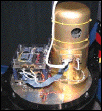
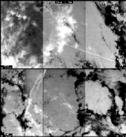
Special maneuvers conducted by the space shuttle allowed a adiometer (far left) to view clouds from different angles for the first time. Satellites normally look straight down on cloud tops.
|
In return, airplanes affect cirrus clouds. The condensation trail created by an airplane passing through water-bearing supercool air causes clouds to form that have the same altitude, temperature and acidity as cirrus clouds. "What we don't know is what would have been there if not for the contrails," Spinhirne said.
To answer these questions, Space Instruments Inc. of Encinitas, Calif., built the Infrared Spectral Imaging Radiometer, which NASA flew alongside a laser altimeter. The radiometer is the first uncooled IR spectral imager to venture beyond Earth's atmosphere. Normally, thermal imagers use bulky, complex cryogenic coolers to boost signal-to-noise ratios.
On Aug. 17, the imager returned to Earth aboard the space shuttle Discovery, bearing more than 50 hours of data. To collect data, the radiometer uses a 327 3 245-microbolometer array from Lockheed Martin Infrared Imaging Systems Inc. of Lexington, Mass., formerly owned by Loral Infrared & Imaging Systems. Based on a design by Honeywell Inc., the sensors have a dynamic range of 0 to 400 K.
Developers use a technique called time delay and integration to boost the signal-to-noise ratio of the microbolometer array. According to Space Instruments' Jim Hoffman, the system combines the signals from up to 40 rows of pixels, one row at a time, to boost the signal intensity.
The multispectral imager uses a mechanical filter wheel to select the four spectral bands: 8.55 µm, 10.8 µm, 12 µm and 8 to 12.5 µm; special electronics constantly calibrate the system.
Measuring brightness
The radiometer measures the infrared brightness of surface clouds, according to Spinhirne. When used in conjunction with the shuttle's laser altimeter, Spinhirne's team deduced the altitude, and therefore the temperature, of the upper cloud layer.
High-resolution infrared imaging then provides additional details such as movement and energy distribution of the clouds. The radiometer beats the performance of existing systems, such as the US government's polar weather satellites, in one other respect: It has four times the resolution.
"A quarter kilometer is optimal resolution for clouds," said Spinhirne. "We've never been able to see all the contrails before [from space]." The infrared capabilities and resolution also allow scientists to view clouds during the nighttime without diurnal or daylight bias, a first for the spaceborne scientific community.
Before the next of two shuttle trips, Spinhirne said his group will verify the instrument's readings with data from an ER2 (the US' new spy plane) underfly, and upgrade the shuttle's laser altimeter to provide full cloud profiling.