As imaging systems improve, they are increasingly taking to the fields and the skies to send back crucial pictures of crop health.
Climate change, population growth and increasingly scarce resources are putting agriculture under pressure. Farmers must be savvy with their land, harvesting as much as possible from the smallest possible space – a new phase in farming known as “precision agriculture.” And photonics is one of the key contributors.
Imaging technologies that once were used exclusively by military and security personnel are broadening their reach and offering improvements in agricultural yields, enabling farmers to plant and harvest at the best times, making the foods we eat safer and better tasting. Photonics is even being used to gauge plant stress.
Near-IR early-warning system
This spring, two small remote-controlled aircraft took flight over potato fields in the Hermiston area of Oregon as part of Oregon State University’s efforts to help farmers more efficiently use water, fertilizers and pesticides to bolster yields and cut costs.
Various cameras onboard the Tetracam Hawkeye vehicles were used to detect plants that weren’t getting enough fertilizer and water. As part of the study, farmers will purposely reduce irrigation and fertilizer on some plants to determine how quickly the equipment detects the stressed plants.
The Tetracam ADC Lite system converts images to a color-IR or CIF format via PixelWrench2 software. The more red coming up from the ground, the more near-IR is being reflected. This level of near-IR typically indicates the presence of healthy vegetation. Areas that equally reflect near-IR, red and green are colored white or gray in the image and are indicative of nonvegetated areas.
Tetracam, based in Chatsworth, Calif., provides multispectral imaging systems, and the company’s ADC Lite will serve as an early warning system for spotting the stressed potatoes. The system captures reflected light with wavelengths ranging from 520 to 920 nm.
“Near-IR radiation is strongly reflected by healthy plants. When plants are stressed – due to a lack of water, nutrients, insect invasion, diseases or other problems – the level of the near-IR radiation that they reflect precipitously drops,” said John Palacio, Tetracam’s vice president of sales and marketing. “This reaction is the same throughout the plant kingdom. It occurs long before plants show any indication of any problem in the visible spectrum.”
The demand for multispectral imaging systems dramatically increased with the introduction of unmanned aerial vehicles (UAV). With the added benefit of precision GPS units, UAVs can now hold a course over fields, pumping a steady stream of GPS coordinates into onboard cameras. Recording this data along with images makes it possible to stitch together individual images into large, accurately georeferenced mosaics.
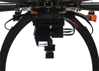
A close-up of Headwall Photonics’ Micro-Hyperspec sensor, which is optimized to be small enough and sufficiently light enough to be carried by easy-to-maneuver UAVs.
“The advent of comparatively low cost and high endurance unmanned aerial vehicles has increased the usability of our systems for a broader market of individuals who need to view systems from the air but cannot afford costs associated with imagery captured via satellites or manned aircraft,” Palacio said.
But there is room for improvement, Palacio added. Currently, the components – the UAV, the multispectral cameras and the prescription mapping software – are all made by different companies. “The immediate future will see better integration of these disparate systems,” he said. “Better integration will make these systems more efficient, less costly and easier to set up and use.”
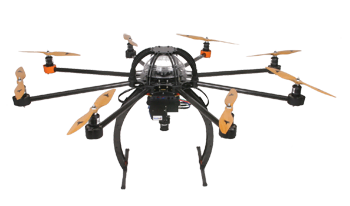
A multirotor UAV known as SkyJib, built by Droidworx Aeronavics of New Zealand, has been teamed with Headwall Photonics’ Micro-Hyperspec system. The pairing is being used in the University of Tasmania’s TerraLuma Project for airborne environmental studies.
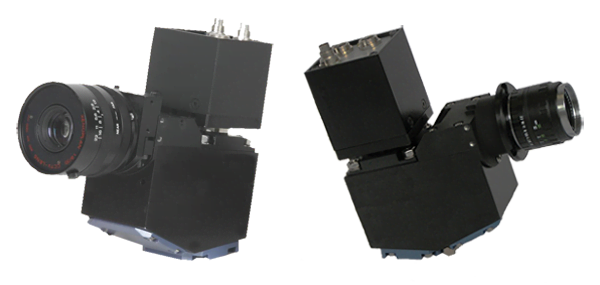
At Headwall Photonics Inc., a designer and manufacturer of spectral imaging systems based in Fitchburg, Mass., precision agriculture and hyperspectral imaging are making perfect partners. Hyperspectral imaging collects and processes information based on the chemical composition (the spectral signature) of the objects or farmland being analyzed.
Airborne deployments are a standard means of operation for hyperspectral sensors and are well suited to the task of surveying large tracts of farmland using both manned aircraft and UAVs. With advantages from “farm to fork,” hyperspectral sensors are used in all phases of cultivation, ranging from airborne precision agriculture, crop science and phenotyping in automated greenhouses to improved food safety and quality in processing centers.
Headwall Photonics’ hyperspectral sensors provide farmers with details of vigor or stress within crops and can be used to help identify the causes of those stresses.
Precision agriculture is the ideal application for hyperspectral imaging, allowing farmers to selectively apply limited resources like fertilizer, water and pesticides, as are fields such as mining and resource exploration. In airborne applications, Headwall’s aberration-corrected sensors obtain a wide field of view while making sure the image fidelity is just as crisp at the edges of the flight path as it is directly beneath the flight line.
“From a photonics perspective, every sensor begins with the grating,” said CEO David Bannon. “Headwall’s high-efficiency diffraction gratings manage light with exceptional precision: Lightweight and athermalized sensors yield optical efficiency of greater than 90 percent and very low stray light.”
Capturing crucial information about the soil conditions, nutrient levels and characteristics of plant stress means that farmers can pick out the best area of land for a particular crop. This affinity for inspection is useful further down the production line and has been recognized by the US Department of Agriculture (USDA).
“Poultry and specialty crop inspection is largely done manually. But humans have a threshold beyond which they cannot see, and certain disease conditions are impossible to detect,” Bannon said. “But the USDA understands that hyperspectral sensors can give the poultry processing industry a new tool and is partnering with Headwall to push the science forward.”
Time to harvest
Back on Earth, a prototype crop-picking robot relies on its camera and image processing unit to pinpoint a plant’s stalk when it comes time to harvest.
Field tests with the first prototype asparagus-picking robot.
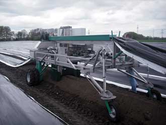
In the European Commission-funded DASH (Demonstration of the AutoSpar Harvesting) project, a working prototype of an asparagus-picking robot is being readied for market. The self-driven vehicle houses a detection system that works with a cutting knife and asparagus gripper driven by a motion mechanism that allows movement in three dimensions.
The second prototype is currently being built; it will be tested and demonstrated during the next harvest. The aim is to have one person operating three or four machines, harvesting more than two hectares per day. This, said DASH coordinator Malte Bethke, will reduce harvesting costs to less than €2 (about $2.62)/kg.
NDVI (normalized difference vegetation index) values vary between +1 and -1. The closer pixels are to +1, the more they indicate healthy vegetation. Pixels closest to -1 indicate complete absence of vegetation.
Optical sensors predict yield
Gauging crop yield months before the harvest is not easy, thanks to a host of elements that can impact growth – and often are out of a farmer’s hands. David Franzen, an extension service soil specialist at North Dakota State University, is hoping to change that.
Franzen and graduate student Lakesh Sharma are using two active optical crop sensors in an attempt to correlate sensor readings taken early on with the total corn gathered at harvest time.
The Greenseeker from Trimble of California and the Crop Circle sensor from Holland Scientific of Nebraska are commonly used handheld optical sensors that provide a measure of crop vigor and classic vegetation index data as well as basic reflectance information from plant canopies and soil, respectively.
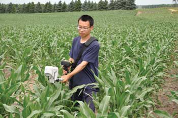
Out in the field, North Dakota State University graduate student Honggang Bu hopes to relate Greenseeker and Holland Crop Circle sensor readings to images captured by satellite.
“We scan our plots at about the six-leaf (V6) corn growth stage, then again 10-14 days later when the corn is at about the 12-leaf stage (V12),” Franzen said. “We divide the readings by the growing degree days from the date of planting to give us a number called the in-season estimate of yield. This number is related to the corn yield at harvest.”
With the final calibrations taking place during this year’s harvest, Franzen and Sharma hope to finalize their algorithms by the summer of 2014.
Photonics in the field
Imaging systems are cropping up in many agricultural areas:
• Tetracam’s imaging systems are being used in Europe to sort grapes according to the quality of the wine they will produce. Belgium-based Aurea Imaging will be flying UAVs over vineyards to determine which grapevines have the highest normalized difference vegetation index (NDVI) values, indicating fruit with high sugar content.
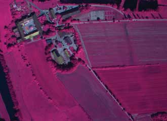
• Tetracam’s ADC system identifies plants encroaching on waterways. Taking pictures of plants growing on water can be a problem due to glare. ADC systems ignore blue, so that water appears black. This contrasts well with plants growing on the water reflecting near-IR, which are depicted in red.
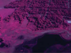
Tetracam’s ADC system identifies plants encroaching on waterways.
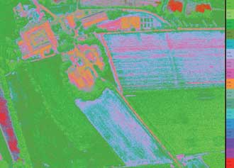
• Honggang Bu, a graduate student of Dr. David Franzen at NDSU, is working on a project funded by the National Science Foundation with co-principal investigator Anne Denton of the NDSU Computer Science department to relate satellite imagery (RapidEye) NDVI values with corn, sugar beet, spring wheat and sunflower yield. They hope to determine whether results similar to those obtained with the Green-seeker from Trimble and Holland Scientific Crop Circle sensors can be provided by satellite imagery alone.
• VineView: Scientific Aerial Imaging is a remote-sensing company that provides precision imaging services to agricultural communities in California, Oregon and Washington. Using Headwall Photonics’ hyperspectral sensors, the company provides wine makers with details of vigor or stress within crops and can help identify the causes of stress.
• QualySense of Dübendorf, Switzerland, is using Headwall Photonics’ hyperspectral sensor operating in the VNIR spectral range in its QSorter. The QSorter will be able to classify and sort grains based on nutrients and contamination levels. Waste will be minimized by identifying seeds and grains that specific algorithms deem to be of poor quality. Foods made from those commodities can then be more effectively processed, utilized and priced.